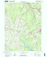
1965 Map of Liberty West
USGS Topo · Published 1989About this map
White Sulphur Springs and the surrounding Catskill foothills appear here in a period of mid-century development. The landscape is defined by its numerous private lakes and recreational sites, such as Swan Lake, Revonah Lake, and Pearl Lake, many of which served the region's historic resort and summer camp economy. Significant local infrastructure is visible, including the Liberty-Loomis Hospital and several reservoirs supporting the growth of the village of Liberty.
Find a feature on this map
65 named features on this map. Tap any name to fly to it.
Don’t see what you’re looking for? This feature index may not catch every label — zoom into the map to look around manually.
Map Details
Editions of this 1965 Liberty West Map
3 editions found
Other maps of this area

1909 · Monticello
USGS Topo · 1:62,500

1910 · Neversink
USGS Topo · 1:62,500

1911 · Monticello
USGS Topo · 1:62,500

1921 · Livingston Manor
USGS Topo · 1:62,500

1922 · White Lake
USGS Topo · 1:62,500

1923 · Livingston Manor
USGS Topo · 1:62,500

1942 · White Lake
USGS Topo · 1:62,500

1942 · Neversink
USGS Topo · 1:62,500

1943 · White Lake
USGS Topo · 1:62,500

1943 · Monticello
USGS Topo · 1:62,500