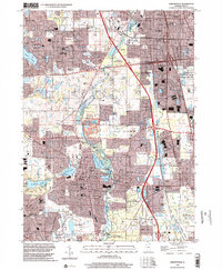
1998 Map of Libertyville
USGS Topo · Published 2002About this map
The Des Plaines River corridor and its extensive forest preserves anchor this Lake County landscape during a period of significant suburban expansion. These protected areas, including Independence Grove County Forest Preserve and MacArthur Woods County Forest Preserve, provide a natural buffer between the growing residential centers of Libertyville, Gurnee, and Mundelein. The map documents a dense network of local schools such as Woodland Sch and Oak Grove Sch, alongside established religious and community sites like St Sava Camp and the sprawling Ascension Cemetery.
Find a feature on this map
62 named features on this map. Tap any name to fly to it.
Don’t see what you’re looking for? This feature index may not catch every label — zoom into the map to look around manually.
Map Details
Editions of this 1998 Libertyville Map
This is the sole edition of this map. No revisions or reprints were ever made.
Other maps of this area

1900 · Highwood
USGS Topo · 1:62,500

1906 · Waukegan
USGS Topo · 1:62,500

1908 · Waukegan
USGS Topo · 1:62,500

1920 · Grays Lake
USGS Topo · 1:62,500

1923 · Grays Lake
USGS Topo · 1:62,500

1923 · Barrington
USGS Topo · 1:62,500

1928 · Wheeling
USGS Topo · 1:24,000

1928 · Highland Park
USGS Topo · 1:24,000

1935 · Barrington
USGS Topo · 1:62,500

1951 · Highland Park
USGS Topo · 1:24,000