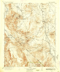
1913 Map of Lida
USGS Topo · Published 1936About this map
Goldfield stands as the primary hub of this high-desert region during a period of intense mining development. The landscape is defined by its industrial lifelines, notably the Bullfrog Goldfield RR and the Tonopah and Goldfield RR, which facilitated the movement of ore from outlying camps. Localized mining activity is evidenced by operations such as the Drinkwater Mine and the Pigeon Stamp Mill, while isolated waypoints like Halfway Station and Forks Station served travelers on the Goldfield Auto Road.
Find a feature on this map
108 named features on this map. Tap any name to fly to it.
Don’t see what you’re looking for? This feature index may not catch every label — zoom into the map to look around manually.
Map Details
Editions of this 1913 Lida Map
5 editions found

Other maps of this area

1898 · Silver Peak
USGS Topo · 1:125,000

1900 · Silver Peak
USGS Topo · 1:125,000

1907 · Mt. Whitney
USGS Topo · 1:125,000

1907 · Tonopah
USGS Topo · 1:250,000

1908 · Kawich
USGS Topo · 1:250,000

1908 · Lida
USGS Topo · 1:250,000

1908 · Furnace Creek
USGS Topo · 1:250,000

1908 · Tonopah
USGS Topo · 1:250,000

1908 · Ballarat
USGS Topo · 1:250,000

1909 · Hawthorne
USGS Topo · 1:250,000