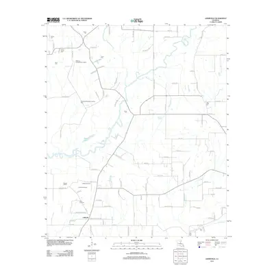
2012 Map of Liddieville
USGS Topo · Published 2012About this map
Liddieville and its surrounding agricultural lands are defined by a complex network of bayous and sloughs in Franklin Parish. The landscape is dotted with small family and community burial grounds, including Nickols Cem, Simms Chapel Cem, and Lone Cedar Cem, offering significant value for genealogical research in this rural pocket of Louisiana. Aviation plays a visible role in the local economy and land management, evidenced by several specialized facilities such as the Goldmine Plantation Landing Strip and the Williams Flying Service Airport. Water moves through the terrain via Mound Bayou and Ash Slough, which weave between agricultural plots and small settlements. The area around Simms Chapel and the Ogden Cemeteries reflects the long-standing community centers that have anchored this parish for generations.
Find a feature on this map
102 named features on this map. Tap any name to fly to it.
Don’t see what you’re looking for? This feature index may not catch every label — zoom into the map to look around manually.
Map Details
Editions of this 2012 Liddieville Map
This is the sole edition of this map. No revisions or reprints were ever made.
Other maps of this area

1935 · Winnsboro
USGS Topo · 1:62,500

1935 · Alto
USGS Topo · 1:62,500

1935 · Baskinton
USGS Topo · 1:62,500

1939 · Fort Necessity
USGS Topo · 1:62,500

1955 · Jackson
USGS Topo · 1:250,000

1957 · Mangham
USGS Topo · 1:62,500

1958 · Baskinton
USGS Topo · 1:62,500

1958 · Winnsboro
USGS Topo · 1:62,500

1958 · Fort Necessity
USGS Topo · 1:62,500

1961 · Jackson
USGS Topo · 1:250,000