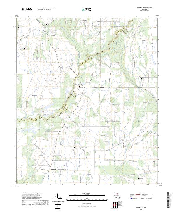
2024 Map of Liddieville
USGS Topo · Published 2024About this map
Liddieville and its surrounding rural landscapes are defined by a network of drainage sloughs and family-named cemeteries that speak to generations of settlement along the border of Richland and Franklin Parishes. The terrain is crisscrossed by namesake roads such as Cummins Rd and Robinson Dairy Rd, reflecting the agricultural heritage of this North Louisiana region. Notable local landmarks include Williams Flying Service, which points to the area's ongoing connection to aerial crop dusting and industrial farming. Waterways like Mound Bayou, Little Creek, and Ash Slough meander through the parish line, illustrating the complex hydrology of the Boeuf River basin. Genealogists will find significant value in the documentation of several local burial grounds, ranging from Simms Chapel Cem to Lone Cedar Cem, providing a spatial record of local family history.
Find a feature on this map
88 named features on this map. Tap any name to fly to it.
Don’t see what you’re looking for? This feature index may not catch every label — zoom into the map to look around manually.
Map Details
Editions of this 2024 Liddieville Map
This is the sole edition of this map. No revisions or reprints were ever made.
Other maps of this area

1935 · Winnsboro
USGS Topo · 1:62,500

1935 · Alto
USGS Topo · 1:62,500

1935 · Baskinton
USGS Topo · 1:62,500

1939 · Fort Necessity
USGS Topo · 1:62,500

1955 · Jackson
USGS Topo · 1:250,000

1957 · Mangham
USGS Topo · 1:62,500

1958 · Baskinton
USGS Topo · 1:62,500

1958 · Winnsboro
USGS Topo · 1:62,500

1958 · Fort Necessity
USGS Topo · 1:62,500

1961 · Jackson
USGS Topo · 1:250,000