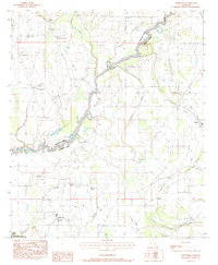
1983 Map of Liddieville
USGS Topo · Published 1984About this map
The agricultural lands of Richland and Franklin Parishes are defined by a complex network of bayous and sloughs in this early 1980s survey. The landscape is dotted with small community centers centered around local churches like Sardis Ch, New Hope Ch, and Lone Cedar Ch. Civil aviation is a notable theme in this region, with several private airfields such as the Goldmine Plantation Landing Strip and Russell Landing Strip serving the surrounding farms. The southwest corner of the map transitions into the Boeuf River Wildlife Management Area, while the primary settlement of Liddieville sits near the southern boundary. This map captures a specific era of rural Louisiana where family cemeteries like Nickols Cem and Austin Cem remain prominent landmarks amidst the winding courses of Big Creek and Mound Bayou.
Find a feature on this map
36 named features on this map. Tap any name to fly to it.
Don’t see what you’re looking for? This feature index may not catch every label — zoom into the map to look around manually.
Map Details
Editions of this 1983 Liddieville Map
This is the sole edition of this map. No revisions or reprints were ever made.
Other maps of this area

1935 · Winnsboro
USGS Topo · 1:62,500

1935 · Alto
USGS Topo · 1:62,500

1935 · Baskinton
USGS Topo · 1:62,500

1939 · Fort Necessity
USGS Topo · 1:62,500

1955 · Jackson
USGS Topo · 1:250,000

1957 · Mangham
USGS Topo · 1:62,500

1958 · Baskinton
USGS Topo · 1:62,500

1958 · Winnsboro
USGS Topo · 1:62,500

1958 · Fort Necessity
USGS Topo · 1:62,500

1961 · Jackson
USGS Topo · 1:250,000