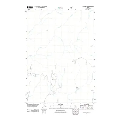
2011 Map of Lightning Ridge
USGS Topo · Published 2011About this map
Lightning Ridge rises above a complex drainage system in this Boise National Forest landscape, where numerous tributaries feed into the larger river systems of Valley County. The terrain is defined by dramatic geological features like the Lightning Creek Rocks and the deeply carved Box Canyon at the edge of the quadrangle. High-altitude hydrology is the central theme here, with water flowing from the Granite Basin through Hailey Creek and Granite Creek toward the southern valleys.
Find a feature on this map
32 named features on this map. Tap any name to fly to it.
Don’t see what you’re looking for? This feature index may not catch every label — zoom into the map to look around manually.
Map Details
Editions of this 2011 Lightning Ridge Map
This is the sole edition of this map. No revisions or reprints were ever made.
Other maps of this area

1909 · Garden Valley
USGS Topo · 1:125,000

1953 · Boiling Springs
USGS Topo · 1:62,500

1953 · Deadwood Reservoir
USGS Topo · 1:62,500

1957 · Challis
USGS Topo · 1:250,000

1959 · Garden Valley
USGS Topo · 1:62,500

1960 · Challis
USGS Topo · 1:250,000

1963 · Challis
USGS Topo · 1:250,000

1972 · Scott Creek
USGS Topo · 1:24,000
1972 · Pine Flat
USGS Topo · 1:24,000

1982 · Deadwood River
USGS Topo · 1:100,000