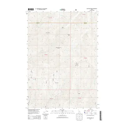
2013 Map of Lightning Ridge
USGS Topo · Published 2013About this map
Boise National Forest encompasses this high-elevation landscape along the boundary of Valley and Boise Counties. The terrain is defined by the prominent Lightning Ridge and Scott Mtn, with drainage networks formed by Lightning Cr and Anderson Cr. This 2013 survey provides a detailed view of the backcountry infrastructure, documenting a web of Forest Service roads such as 668 and 555c that navigate through Granite Basin and Lookout Canyon. The presence of landmarks like Lightning Creek Rocks and Onion Valley highlights the topographic diversity of the region. For those studying the management of public lands or tracing historical access routes through the central Idaho wilderness, these recorded paths and natural features offer a clear picture of the area's contemporary geography.
Find a feature on this map
41 named features on this map. Tap any name to fly to it.
Don’t see what you’re looking for? This feature index may not catch every label — zoom into the map to look around manually.
Map Details
Editions of this 2013 Lightning Ridge Map
This is the sole edition of this map. No revisions or reprints were ever made.
Other maps of this area

1909 · Garden Valley
USGS Topo · 1:125,000

1953 · Boiling Springs
USGS Topo · 1:62,500

1953 · Deadwood Reservoir
USGS Topo · 1:62,500

1957 · Challis
USGS Topo · 1:250,000

1959 · Garden Valley
USGS Topo · 1:62,500

1960 · Challis
USGS Topo · 1:250,000

1963 · Challis
USGS Topo · 1:250,000

1972 · Scott Creek
USGS Topo · 1:24,000
1972 · Pine Flat
USGS Topo · 1:24,000

1982 · Deadwood River
USGS Topo · 1:100,000