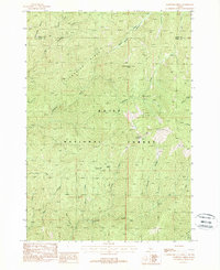
1988 Map of Lightning Ridge
USGS Topo · Published 1989About this map
Scott Mountain 8214 Lookout anchors the high terrain of the Boise National Forest in this late-1980s topographic study. The landscape is defined by the massive spines of Lightning Ridge and Bulldog Ridge, which separate a complex network of drainages across the Valley and Boise County line. This provisional survey captures the wilderness character of the region before significant modern changes, illustrating the isolated hydrology of basins like Granite Basin and the Onion Creek Valley.
Find a feature on this map
25 named features on this map. Tap any name to fly to it.
Don’t see what you’re looking for? This feature index may not catch every label — zoom into the map to look around manually.
Map Details
Editions of this 1988 Lightning Ridge Map
This is the sole edition of this map. No revisions or reprints were ever made.
Other maps of this area

1909 · Garden Valley
USGS Topo · 1:125,000

1953 · Boiling Springs
USGS Topo · 1:62,500

1953 · Deadwood Reservoir
USGS Topo · 1:62,500

1957 · Challis
USGS Topo · 1:250,000

1959 · Garden Valley
USGS Topo · 1:62,500

1960 · Challis
USGS Topo · 1:250,000

1963 · Challis
USGS Topo · 1:250,000

1972 · Scott Creek
USGS Topo · 1:24,000
1972 · Pine Flat
USGS Topo · 1:24,000

1982 · Deadwood River
USGS Topo · 1:100,000