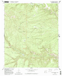
1965 Map of Lilley Mountain
USGS Topo · Published 1992About this map
Lilley Mountain stands at the heart of this high-country landscape within the Gila Wilderness and Gila National Forest. The map, based on fieldwork from the mid-1960s, documents a network of isolated outposts and trails used by forest rangers and backcountry travelers. Key landmarks include the Trotter Cabin and White Creek Cabin, providing essential shelter in a terrain defined by deep drainages like Hells Hole and the Middle Fork Gila River.
Find a feature on this map
39 named features on this map. Tap any name to fly to it.
Don’t see what you’re looking for? This feature index may not catch every label — zoom into the map to look around manually.
Map Details
Editions of this 1965 Lilley Mountain Map
2 editions found
Other maps of this area

1910 · Mogollon
USGS Topo · 1:125,000

1911 · Alum Mountain
USGS Topo · 1:125,000

1912 · Mogollon
USGS Topo · 1:125,000

1913 · Alum Mountain
USGS Topo · 1:125,000

1954 · Clifton
USGS Topo · 1:250,000

1957 · Clifton
USGS Topo · 1:250,000

1958 · Clifton
USGS Topo · 1:250,000

1962 · Clifton
USGS Topo · 1:250,000

1963 · Negrito Mountain
USGS Topo · 1:24,000
1963 · Loco Mountain
USGS Topo · 1:24,000