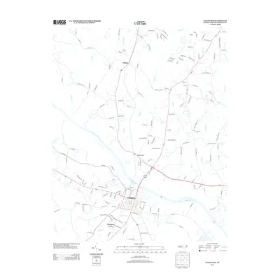
2013 Map of Lillington
USGS Topo · Published 2013About this map
The Cape Fear River serves as the central artery for this section of Harnett County, shaping the development of the county seat at Lillington. In the early 21st century, the landscape reflects a transition from its rural origins to more structured residential growth, seen in the grid of the town center and the sprawling networks of roads like Christian Light Rd and Kipling Rd. Local history is preserved in the names of outlying settlements like Kipling and Shawtown, as well as the unincorporated area of Cape Fear. The map details the numerous watercourses that drain toward the main river, including Neills Cr, Poorhouse Cr, and Indian Br, which define the topography between the upland ridges and the river basin. Family-named landmarks and rural routes, such as Samuel McKoy Ln and Cemetery Rd, offer specific points of interest for genealogical research and local land-use studies.
Find a feature on this map
149 named features on this map. Tap any name to fly to it.
Don’t see what you’re looking for? This feature index may not catch every label — zoom into the map to look around manually.
Map Details
Editions of this 2013 Lillington Map
This is the sole edition of this map. No revisions or reprints were ever made.
Other maps of this area

1953 · Raleigh
USGS Topo · 1:250,000

1954 · Raleigh
USGS Topo · 1:250,000

1956 · Anderson Creek
USGS Topo · 1:24,000

1956 · Bunnlevel
USGS Topo · 1:24,000

1964 · Angier
USGS Topo · 1:24,000

1964 · Garner
USGS Topo · 1:62,500

1973 · Erwin
USGS Topo · 1:24,000

1973 · Coats
USGS Topo · 1:24,000
1974 · Fuquay-Varina
USGS Topo · 1:24,000

1974 · Mamers
USGS Topo · 1:24,000