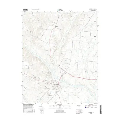
2016 Map of Lillington
USGS Topo · Published 2016About this map
Lillington serves as the focal point of this Harnett County landscape, situated at a bend in the Cape Fear River. The town's grid is dense with street names, transitioning south into the community of Shawtown. Upriver, the settlement of Cape Fear and the northern village of Kipling illustrate the historic residential patterns of the region. The map is particularly valuable for genealogical research, documenting numerous burial sites such as Harnett Memorial Cem, Smith Cem, and Olive Branch Cem. Tributaries like Hector Cr, W Buies Cr, and Poorhouse Cr carve through the terrain, while Johnson Field stands out as a clear landmark in the northwestern quadrant. The road network connects these points via routes like Harnett Central Rd and Kipling Rd, reaching toward the edge of Angier in the northeast.
Find a feature on this map
115 named features on this map. Tap any name to fly to it.
Don’t see what you’re looking for? This feature index may not catch every label — zoom into the map to look around manually.
Map Details
Editions of this 2016 Lillington Map
This is the sole edition of this map. No revisions or reprints were ever made.
Other maps of this area

1953 · Raleigh
USGS Topo · 1:250,000

1954 · Raleigh
USGS Topo · 1:250,000

1956 · Anderson Creek
USGS Topo · 1:24,000

1956 · Bunnlevel
USGS Topo · 1:24,000

1964 · Angier
USGS Topo · 1:24,000

1964 · Garner
USGS Topo · 1:62,500

1973 · Erwin
USGS Topo · 1:24,000

1973 · Coats
USGS Topo · 1:24,000
1974 · Fuquay-Varina
USGS Topo · 1:24,000

1974 · Mamers
USGS Topo · 1:24,000