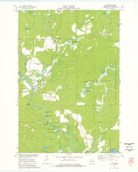
1973 Map of Lily
USGS Topo · Published 1977About this map
The Wolf River and Lily River converge in this northern Wisconsin landscape, anchoring a region defined by extensive wetlands and protected fishery areas. The settlement of Lily sits at the junction of these waterways, serving as a focal point near the Lily Cem and several gravel pits that mark the local industry. To the north, Dennison Swamp and Lily Springs feed into the river system, while the Lily Springs State Fishery Area preserves the delicate aquatic environment.
Find a feature on this map
32 named features on this map. Tap any name to fly to it.
Don’t see what you’re looking for? This feature index may not catch every label — zoom into the map to look around manually.
Map Details
Editions of this 1973 Lily Map
This is the sole edition of this map. No revisions or reprints were ever made.
Other maps of this area

1942 · Wabeno
USGS Topo · 1:48,000

1942 · Pearson
USGS Topo · 1:48,000

1950 · Wabeno
USGS Topo · 1:48,000

1950 · Lily
USGS Topo · 1:48,000

1951 · Wabeno
USGS Topo · 1:48,000

1952 · White Lake
USGS Topo · 1:48,000

1952 · Langlade
USGS Topo · 1:48,000

1954 · Iron Mountain
USGS Topo · 1:250,000

1959 · Iron Mountain
USGS Topo · 1:250,000
1972 · Wabeno
USGS Topo · 1:24,000