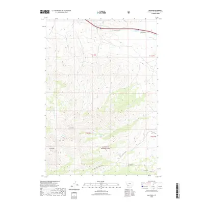
2020 Map of Lima Peaks
USGS Topo · Published 2020About this map
Lima Peaks and Garfield Mtn dominate this high-altitude landscape within the Beaverhead National Forest, marking a significant stretch of the Continental Divide National Scenic Trail. The terrain is defined by a series of drainages, including Little Sheep Creek, Deep Creek, and Crooked Run Creek, which flow through deep basins like Dutch Hollow. Human impact on the land is represented by utilitarian routes such as the Snowline Stock Ln and Sawmill Creek Rd, suggesting a history of livestock management and resource access. Several natural water sources, such as Dutch Hollow Spring and Lower Deep Creek Spring, provide essential watering points in this arid, mountainous environment. The mapping of township and range boundaries like t14s r8w further illustrates the formal land organization across these remote Montana summits.
Find a feature on this map
30 named features on this map. Tap any name to fly to it.
Don’t see what you’re looking for? This feature index may not catch every label — zoom into the map to look around manually.
Map Details
Editions of this 2020 Lima Peaks Map
This is the sole edition of this map. No revisions or reprints were ever made.
Other maps of this area

1955 · Dubois
USGS Topo · 1:250,000

1957 · Paul Reservoir
USGS Topo · 1:62,500

1957 · Edie Ranch
USGS Topo · 1:62,500

1958 · Dubois
USGS Topo · 1:250,000

1965 · Gallagher Gulch
USGS Topo · 1:24,000

1965 · Lima
USGS Topo · 1:24,000

1965 · Dell
USGS Topo · 1:24,000

1965 · Lima Peaks
USGS Topo · 1:24,000

1968 · Snowline
USGS Topo · 1:24,000

1968 · Henry Gulch
USGS Topo · 1:24,000