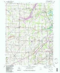
1994 Map of Limaville
USGS Topo · Published 1997About this map
The boundary between Portage and Stark Counties anchors a landscape defined by water management and rural settlement patterns. Extensive hydrological features like the Walborn Reservoir and the Berlin Lake state wildlife area dominate the northern reaches, while the Conrail line traverses the southern half, linking the industrial outskirts of Alliance with the rural crossroads of Maximo. The map reveals a transition from these large-scale water bodies to a grid of township roads punctuated by family-named cemeteries and community landmarks.
Find a feature on this map
82 named features on this map. Tap any name to fly to it.
Don’t see what you’re looking for? This feature index may not catch every label — zoom into the map to look around manually.
Map Details
Editions of this 1994 Limaville Map
This is the sole edition of this map. No revisions or reprints were ever made.
Other maps of this area

1901 · Canton
USGS Topo · 1:62,500

1903 · Canton
USGS Topo · 1:62,500

1906 · Kent
USGS Topo · 1:62,500

1906 · Ravenna
USGS Topo · 1:62,500

1908 · Ravenna
USGS Topo · 1:62,500

1909 · Alliance
USGS Topo · 1:62,500

1950 · Cleveland
USGS Topo · 1:250,000

1951 · Canton
USGS Topo · 1:250,000

1952 · Alliance
USGS Topo · 1:24,000

1953 · Canton
USGS Topo · 1:250,000