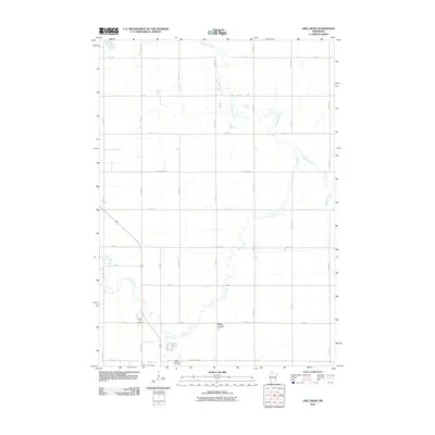
2010 Map of Lime Creek
USGS Topo · Published 2010About this map
Lime Creek sits at the heart of this agricultural landscape in Murray County, where the eponymous stream meanders through a grid of rural sections before joining the Des Moines River to the east. The map documents a classic Midwestern township structure, defined by a rigid network of numbered avenues and streets that partition the prairie into large farmsteads. Local history is anchored by the presence of Prairie Hill Cemetery and Saint Gabriel Cemetery, which serve as quiet markers of the community's ancestral roots near the southern border. The transition from the open fields to the wooded riparian corridors along the water is clear, illustrating the importance of natural drainage in this productive region. Arteries like County Hwy-6 and County Hwy-40 provide the primary links between the settlement and the surrounding township.
Find a feature on this map
24 named features on this map. Tap any name to fly to it.
Don’t see what you’re looking for? This feature index may not catch every label — zoom into the map to look around manually.
Map Details
Editions of this 2010 Lime Creek Map
This is the sole edition of this map. No revisions or reprints were ever made.
Other maps of this area

1953 · New Ulm
USGS Topo · 1:250,000

1954 · Fairmont
USGS Topo · 1:250,000

1957 · New Ulm
USGS Topo · 1:250,000

1958 · New Ulm
USGS Topo · 1:250,000

1958 · Fairmont
USGS Topo · 1:250,000

1967 · New Ulm
USGS Topo · 1:250,000

1967 · Dovray
USGS Topo · 1:24,000
1967 · Currie
USGS Topo · 1:24,000
1967 · Westbrook
USGS Topo · 1:24,000

1970 · Heron Lake NW
USGS Topo · 1:24,000