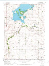
1967 Map of Currie
USGS Topo · Published 1969About this map
Lake Shetek and its complex shoreline dominate the landscape of Murray County in this late 1960s study, revealing a region defined by recreational development and water management. The survey documents Lake Shetek State Park in detail, noting its infrastructure from the Lookout Tower and Fish Hatchery to organized youth areas like the Boy Scout Camp and Shetek Church Camp. These features, alongside Keeley Island and Loon Island, illustrate the lake's transition into a regional leisure hub.
Find a feature on this map
35 named features on this map. Tap any name to fly to it.
Don’t see what you’re looking for? This feature index may not catch every label — zoom into the map to look around manually.
Map Details
Editions of this 1967 Currie Map
2 editions found
Other maps of this area

1953 · New Ulm
USGS Topo · 1:250,000

1954 · Fairmont
USGS Topo · 1:250,000

1957 · New Ulm
USGS Topo · 1:250,000

1958 · New Ulm
USGS Topo · 1:250,000

1958 · Fairmont
USGS Topo · 1:250,000

1967 · New Ulm
USGS Topo · 1:250,000

1967 · Balaton
USGS Topo · 1:24,000

1967 · Slayton
USGS Topo · 1:24,000

1967 · Tracy East
USGS Topo · 1:24,000

1967 · Hadley
USGS Topo · 1:24,000