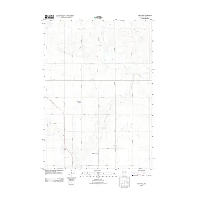
2013 Map of Lime Creek
USGS Topo · Published 2013About this map
Lime Creek sits within the high glacial landscape of the Coteau des Prairies, a prominent plateau in southwestern Minnesota. This survey documents a rural Murray County landscape defined by the upper reaches of the Des Moines River and its tributary, Lime Creek. The grid of section roads and the corridor of Us-59 reveal a meticulously organized agricultural region, where small community landmarks remain vital. Genealogists and local historians can find the locations of Saint Gabriel Cem and Prairie Hill Cem, which serve as physical anchors for the surrounding farmstead families. The map illustrates how local geography and early transit routes, such as Co HWY-40, shaped the settlement patterns of this prairie region.
Find a feature on this map
26 named features on this map. Tap any name to fly to it.
Don’t see what you’re looking for? This feature index may not catch every label — zoom into the map to look around manually.
Map Details
Editions of this 2013 Lime Creek Map
This is the sole edition of this map. No revisions or reprints were ever made.
Other maps of this area

1953 · New Ulm
USGS Topo · 1:250,000

1954 · Fairmont
USGS Topo · 1:250,000

1957 · New Ulm
USGS Topo · 1:250,000

1958 · New Ulm
USGS Topo · 1:250,000

1958 · Fairmont
USGS Topo · 1:250,000

1967 · New Ulm
USGS Topo · 1:250,000

1967 · Dovray
USGS Topo · 1:24,000
1967 · Currie
USGS Topo · 1:24,000
1967 · Westbrook
USGS Topo · 1:24,000

1970 · Heron Lake NW
USGS Topo · 1:24,000