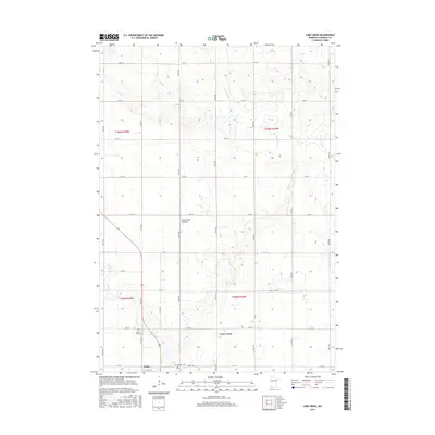
2016 Map of Lime Creek
USGS Topo · Published 2016About this map
The glacial upland known as the Coteau des Prairies defines the topography of this corner of Murray County, where the headwaters of the Des Moines River and Lime Cr carve through the agricultural landscape. The settlement of Fulda anchors the southwestern portion of the sheet, serving as a local hub near the intersection of several county thoroughfares. Further north, the smaller community of Lime Creek sits along the banks of its namesake waterway, illustrating the historical pattern of village placement near reliable water sources in the late nineteenth-century prairie.
Find a feature on this map
33 named features on this map. Tap any name to fly to it.
Don’t see what you’re looking for? This feature index may not catch every label — zoom into the map to look around manually.
Map Details
Editions of this 2016 Lime Creek Map
This is the sole edition of this map. No revisions or reprints were ever made.
Other maps of this area

1953 · New Ulm
USGS Topo · 1:250,000

1954 · Fairmont
USGS Topo · 1:250,000

1957 · New Ulm
USGS Topo · 1:250,000

1958 · New Ulm
USGS Topo · 1:250,000

1958 · Fairmont
USGS Topo · 1:250,000

1967 · New Ulm
USGS Topo · 1:250,000

1967 · Dovray
USGS Topo · 1:24,000
1967 · Currie
USGS Topo · 1:24,000
1967 · Westbrook
USGS Topo · 1:24,000

1970 · Heron Lake NW
USGS Topo · 1:24,000