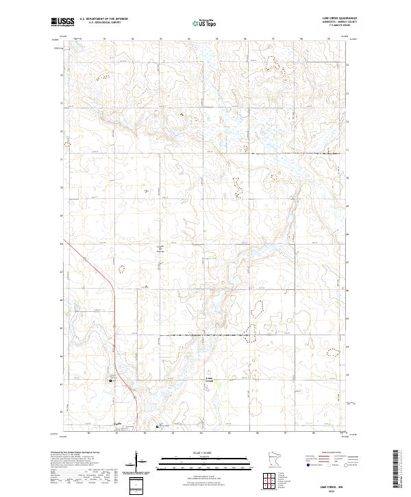
2022 Map of Lime Creek
USGS Topo · Published 2022About this map
The high plateau of the Coteau des Prairies defines the geography of this southern Minnesota landscape, where the headwaters of the Des Moines River and Lime Cr begin their journey. The settlement of Lime Creek sits at a crossroads in the central portion of the map, while the northern outskirts of Fulda appear along the southern boundary. This 2022 survey illustrates the grid-based rural development of Murray County, with local routes like Co Hwy 40 and Co Hwy 39 connecting scattered farmsteads across the township lines of T106N and T105N. Genealogists and local historians will find significant landmarks in the Prairie Hill Cem and Saint Gabriel Cem, which remain as essential touchstones for the families who have worked this agricultural upland for generations.
Find a feature on this map
33 named features on this map. Tap any name to fly to it.
Don’t see what you’re looking for? This feature index may not catch every label — zoom into the map to look around manually.
Map Details
Editions of this 2022 Lime Creek Map
This is the sole edition of this map. No revisions or reprints were ever made.
Other maps of this area

1953 · New Ulm
USGS Topo · 1:250,000

1954 · Fairmont
USGS Topo · 1:250,000

1957 · New Ulm
USGS Topo · 1:250,000

1958 · New Ulm
USGS Topo · 1:250,000

1958 · Fairmont
USGS Topo · 1:250,000

1967 · New Ulm
USGS Topo · 1:250,000

1967 · Dovray
USGS Topo · 1:24,000
1967 · Currie
USGS Topo · 1:24,000
1967 · Westbrook
USGS Topo · 1:24,000

1970 · Heron Lake NW
USGS Topo · 1:24,000