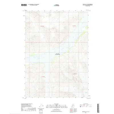
2017 Map of Lime Hills A-1 SE
USGS Topo · Published 2017About this map
Lake Clark National Park encompasses this high-altitude landscape where the towering peaks of the Aleutian Range meet the valley of the Neacola River. The river forms a central corridor through the topography, winding through a wide glacial valley fed by the surrounding ice fields. Near the southeastern boundary, the Shamrock Glacier stands as a testament to the ongoing glacial processes that have carved the deep valleys and sharp ridges visible throughout this section of the Kenai Peninsula. The lack of any roads or buildings emphasizes the protected wilderness character of the park, providing a view of the terrain in its natural state during the early twenty-first century.
Find a feature on this map
8 named features on this map. Tap any name to fly to it.
Don’t see what you’re looking for? This feature index may not catch every label — zoom into the map to look around manually.
Map Details
Editions of this 2017 Lime Hills A-1 SE Map
This is the sole edition of this map. No revisions or reprints were ever made.
Other maps of this area

1944 · Kenai
USGS Topo · 1:250,000

1946 · Lake Clark
USGS Topo · 1:250,000

1949 · Tyonek
USGS Topo · 1:250,000

1950 · Kenai
USGS Topo · 1:250,000

1951 · Lake Clark
USGS Topo · 1:250,000

1951 · Tyonek
USGS Topo · 1:250,000

1951 · Lime Hills
USGS Topo · 1:250,000

1958 · Kenai D-8
USGS Topo · 1:63,360

1958 · Tyonek
USGS Topo · 1:250,000

1958 · Tyonek A-8
USGS Topo · 1:63,360