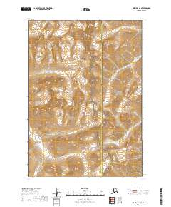
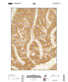
2019 Map of Lime Hills A-2 SE
USGS Topo · Published 2019About this map
The Tlikakila River winds through a high mountain corridor where the Bethel Census Area Kenai Peninsula Borough boundary meets the protected wilderness of southwest Alaska. This landscape is defined by its transition between two major conservation areas: the Lake Clark National Preserve and Lake Clark National Park. The topography shown here represents the intricate drainage systems and glacial valleys that feed into the larger Lake Clark basin, a region essential to the cultural and natural history of the Dena'ina people.
Find a feature on this map
8 named features on this map. Tap any name to fly to it.
Don’t see what you’re looking for? This feature index may not catch every label — zoom into the map to look around manually.
Map Details
Editions of this 2019 Lime Hills A-2 SE Map
This is the sole edition of this map. No revisions or reprints were ever made.
Other maps of this area

1946 · Lake Clark
USGS Topo · 1:250,000

1951 · Lake Clark
USGS Topo · 1:250,000

1951 · Lime Hills
USGS Topo · 1:250,000

1958 · Lime Hills A-2
USGS Topo · 1:63,360
1958 · Lake Clark D-2
USGS Topo · 1:63,360
1958 · Lime Hills A-1
USGS Topo · 1:63,360
1958 · Lake Clark D-1
USGS Topo · 1:63,360

1958 · Lake Clark
USGS Topo · 1:250,000

1958 · Lime Hills
USGS Topo · 1:250,000
2018 · Lake Clark D-1 NW
USGS Topo · 1:25,000