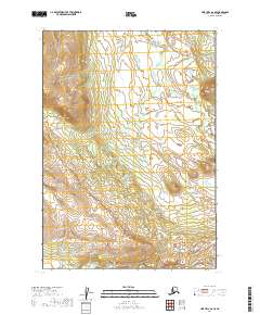
2019 Map of Lime Hills A-6 SE
USGS Topo · Published 2019About this map
Can Cr meanders through this portion of the Bethel Census Area, defining the drainage patterns in a landscape devoid of named human settlements. This 2019 data from the U.S. Geological Survey reveals a wilderness characterized by dramatic elevation shifts, where high ridgelines overlook the sinuous course of the creek. The absence of roads or structures within t12n r33w and t11n r32w underscores the isolated nature of the terrain. For the researcher or traveler, the map serves as a primary record of the physical geography, illustrating how the water of Can Cr is the central organizing feature of the topography in this unpopulated reach of the Lime Hills.
Find a feature on this map
5 named features on this map. Tap any name to fly to it.
Don’t see what you’re looking for? This feature index may not catch every label — zoom into the map to look around manually.
Map Details
Editions of this 2019 Lime Hills A-6 SE Map
This is the sole edition of this map. No revisions or reprints were ever made.
Other maps of this area

1946 · Lake Clark
USGS Topo · 1:250,000

1951 · Lake Clark
USGS Topo · 1:250,000

1951 · Lime Hills
USGS Topo · 1:250,000

1954 · Lime Hills A-5
USGS Topo · 1:63,360

1954 · Lake Clark D-5
USGS Topo · 1:63,360

1954 · Lime Hills A-6
USGS Topo · 1:63,360
1954 · Lake Clark D-6
USGS Topo · 1:63,360

1958 · Lake Clark
USGS Topo · 1:250,000

1958 · Lime Hills
USGS Topo · 1:250,000
2018 · Lake Clark D-5 NW
USGS Topo · 1:25,000