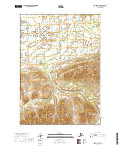
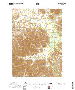
2019 Map of Lime Hills A-7 NW
USGS Topo · Published 2019About this map
Caribou Snare Cr winds through a landscape of intricate hydrology and varied elevation in the Bethel Census Area. The terrain transition is stark, with the northern portion of the quadrangle defined by expansive wetlands and complex lake systems, while the southern reaches rise into significant upland formations. This 2019 survey, produced by the U.S. Geological Survey, meticulously details the public land divisions including t13n r35w, t13n r34w, t12n r36w, and t12n r35w. The lack of roads or infrastructure underscores the remote character of this Alaskan interior, where the natural drainage of the creek and the dense concentration of nameless lakes serve as the primary landmarks for navigation and land study.
Find a feature on this map
5 named features on this map. Tap any name to fly to it.
Don’t see what you’re looking for? This feature index may not catch every label — zoom into the map to look around manually.
Map Details
Editions of this 2019 Lime Hills A-7 NW Map
This is the sole edition of this map. No revisions or reprints were ever made.
Other maps of this area

1951 · Lime Hills
USGS Topo · 1:250,000

1954 · Lime Hills A-8
USGS Topo · 1:63,360

1954 · Lime Hills B-7
USGS Topo · 1:63,360

1954 · Lime Hills A-7
USGS Topo · 1:63,360

1954 · Lime Hills B-8
USGS Topo · 1:63,360

1958 · Lime Hills
USGS Topo · 1:250,000
2019 · Lime Hills A-8 SE
USGS Topo · 1:25,000
2019 · Lime Hills B-8 SE
USGS Topo · 1:25,000
2019 · Lime Hills A-7 SW
USGS Topo · 1:25,000
2019 · Lime Hills A-7 SE
USGS Topo · 1:25,000