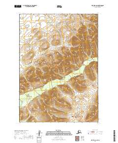
2019 Map of Lime Hills A-8 SE
USGS Topo · Published 2019About this map
Hook Cr flows through this expanse of the Alaska wilderness, cutting through the interior of the Bethel Census Area. This mapping of the Lime Hills region showcases the intricate drainage patterns and elevation profiles of the high country, defined by the boundaries of t12n r37w, t12n r36w, t11n r37w, and t11n r36w. The topography reveals a landscape dominated by complex ridge systems and the central valley formed by Hook Cr, illustrating the remote hydrological network before any significant modern infrastructure or settlement development reached this portion of the interior.
Find a feature on this map
5 named features on this map. Tap any name to fly to it.
Don’t see what you’re looking for? This feature index may not catch every label — zoom into the map to look around manually.
Map Details
Editions of this 2019 Lime Hills A-8 SE Map
This is the sole edition of this map. No revisions or reprints were ever made.
Other maps of this area

1946 · Lake Clark
USGS Topo · 1:250,000

1951 · Lake Clark
USGS Topo · 1:250,000

1951 · Lime Hills
USGS Topo · 1:250,000

1954 · Lime Hills A-8
USGS Topo · 1:63,360

1954 · Lake Clark D-8
USGS Topo · 1:63,360

1954 · Lake Clark D-7
USGS Topo · 1:63,360

1954 · Lime Hills A-7
USGS Topo · 1:63,360

1958 · Lake Clark
USGS Topo · 1:250,000

1958 · Lime Hills
USGS Topo · 1:250,000
2019 · Lake Clark D-7 NW
USGS Topo · 1:25,000