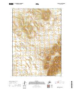
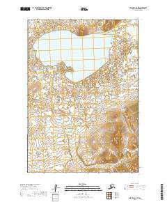
2019 Map of Lime Hills B-8 SE
USGS Topo · Published 2019About this map
Lime Hills dominate the terrain of this interior region, with the landscape defined by its high-altitude ridges and complex drainage patterns. The Stink River winds through the western portion of the map, carving a path between the steep elevations that characterize the local geography. This 2019 survey documents the unpopulated expanse as it appeared in the early 21st century, illustrating the relationship between the dramatic topography and the watershed systems. The map provides a precise account of the public land survey system divisions, including t14n r36w and t15n r35w, which remain fundamental to understanding the geographic organization of this part of the Bethel Census Area.
Find a feature on this map
8 named features on this map. Tap any name to fly to it.
Don’t see what you’re looking for? This feature index may not catch every label — zoom into the map to look around manually.
Map Details
Editions of this 2019 Lime Hills B-8 SE Map
This is the sole edition of this map. No revisions or reprints were ever made.
Other maps of this area

1951 · Lime Hills
USGS Topo · 1:250,000

1954 · Lime Hills A-8
USGS Topo · 1:63,360

1954 · Lime Hills B-7
USGS Topo · 1:63,360

1954 · Lime Hills A-7
USGS Topo · 1:63,360

1954 · Lime Hills B-8
USGS Topo · 1:63,360

1958 · Lime Hills
USGS Topo · 1:250,000
2019 · Lime Hills B-7 NW
USGS Topo · 1:25,000
2019 · Lime Hills A-8 NW
USGS Topo · 1:25,000
2019 · Lime Hills B-8 SW
USGS Topo · 1:25,000
2019 · Lime Hills A-8 NE
USGS Topo · 1:25,000