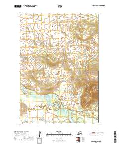
2019 Map of Lime Hills B-7 NW
USGS Topo · Published 2019About this map
The Stony River winds through the southern reaches of this landscape, creating a complex network of braids and islands as it cuts through the Bethel Census Area. The terrain is defined by dramatic elevation changes, with the river valley flanked by significant ridges and drainages that shape the local watershed. This 2019 survey documents the vast, uninhabited reaches of interior Alaska, where the lack of established roads or settlements highlights the isolation of the region. The map provides precise survey boundaries for t16n r35w, t15n r35w, and neighboring townships, offering a detailed topographic record of the landforms surrounding the river corridor. For researchers and cartographic enthusiasts, this sheet serves as a primary reference for the shifting hydrology and natural topography of the Lime Hills region.
Find a feature on this map
5 named features on this map. Tap any name to fly to it.
Don’t see what you’re looking for? This feature index may not catch every label — zoom into the map to look around manually.
Map Details
Editions of this 2019 Lime Hills B-7 NW Map
This is the sole edition of this map. No revisions or reprints were ever made.
Other maps of this area

1951 · Lime Hills
USGS Topo · 1:250,000
1954 · Lime Hills C-7
USGS Topo · 1:63,360

1954 · Lime Hills B-7
USGS Topo · 1:63,360

1954 · Lime Hills B-8
USGS Topo · 1:63,360
1958 · Lime Hills C-8
USGS Topo · 1:63,360

1958 · Lime Hills
USGS Topo · 1:250,000
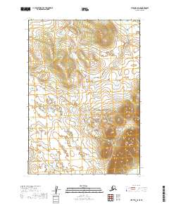
2019 · Lime Hills B-8 SE
USGS Topo · 1:25,000
2019 · Lime Hills C-7 SW
USGS Topo · 1:25,000
2019 · Lime Hills B-7 NE
USGS Topo · 1:25,000
2019 · Lime Hills C-8 SE
USGS Topo · 1:25,000