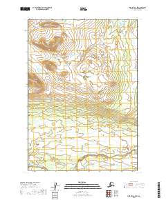
2019 Map of Lime Hills B-5 SW
USGS Topo · Published 2019About this map
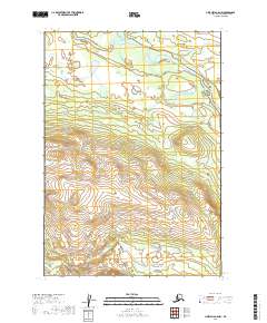
Stony River flows across the southwestern corner of this topographic study, anchoring a landscape defined by dramatic elevation changes in the Bethel region. The terrain is characterized by a series of northwest-trending ridges and valleys, with contour lines indicating significant vertical relief. In the southeastern portion, the drainage of Little Underhill Creek cuts through the lower elevations. This survey captures a remote portion of the Alaska interior, documenting the natural hydrologic patterns and township boundaries including t14n r31w and t14n r30w before modern infrastructure or significant human settlements reached this particular quadrant. The absence of roads or named structures emphasizes the wild character of the territory at the time of this 2019 data collection.
Find a feature on this map
9 named features on this map. Tap any name to fly to it.
Don’t see what you’re looking for? This feature index may not catch every label — zoom into the map to look around manually.
Map Details
Editions of this 2019 Lime Hills B-5 SW Map
This is the sole edition of this map. No revisions or reprints were ever made.
Other maps of this area

1951 · Lime Hills
USGS Topo · 1:250,000

1954 · Lime Hills A-5
USGS Topo · 1:63,360

1954 · Lime Hills B-5
USGS Topo · 1:63,360

1954 · Lime Hills A-6
USGS Topo · 1:63,360

1954 · Lime Hills B-6
USGS Topo · 1:63,360

1958 · Lime Hills
USGS Topo · 1:250,000
2019 · Lime Hills B-5 NW
USGS Topo · 1:25,000
2019 · Lime Hills B-5 SE
USGS Topo · 1:25,000
2019 · Lime Hills A-5 NE
USGS Topo · 1:25,000
2019 · Lime Hills A-5 NW
USGS Topo · 1:25,000