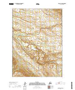
2019 Map of Lime Hills A-5 NE
USGS Topo · Published 2019About this map
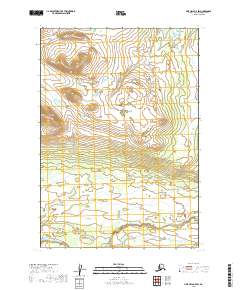
The Stony River winds through this expanse of the Bethel Census Area, carving a deep alluvial path through the landscape of interior Alaska. The drainage patterns of Underhill Cr and Rock Cr reveal the complex hydrology of this region, where seasonal melt and glacial runoff dictate the shape of the land. In this 2019 survey, the absence of named settlements or roads highlights the primary role of natural waterways as the essential corridors for travel and subsistence. The map provides a detailed view of the terrain at the intersection of several townships, including t13n r30w and t12n r30w, illustrating the transition from low-lying river bottoms to the rising elevations of the surrounding hills.
Find a feature on this map
7 named features on this map. Tap any name to fly to it.
Don’t see what you’re looking for? This feature index may not catch every label — zoom into the map to look around manually.
Map Details
Editions of this 2019 Lime Hills A-5 NE Map
This is the sole edition of this map. No revisions or reprints were ever made.
Other maps of this area

1951 · Lime Hills
USGS Topo · 1:250,000

1954 · Lime Hills A-5
USGS Topo · 1:63,360

1954 · Lime Hills B-4
USGS Topo · 1:63,360

1954 · Lime Hills A-4
USGS Topo · 1:63,360

1954 · Lime Hills B-5
USGS Topo · 1:63,360

1958 · Lime Hills
USGS Topo · 1:250,000
2019 · Lime Hills B-5 SE
USGS Topo · 1:25,000
2019 · Lime Hills A-5 SE
USGS Topo · 1:25,000
2019 · Lime Hills A-4 SW
USGS Topo · 1:25,000
2019 · Lime Hills B-5 SW
USGS Topo · 1:25,000