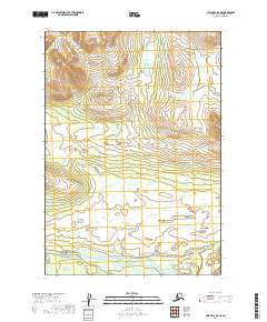
2019 Map of Lime Hills B-6 SE
USGS Topo · Published 2019About this map
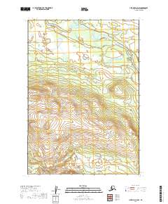
Stony River flows through the southern portion of this remote landscape in the Bethel Census Area, serving as the dominant hydrological feature in an area defined by significant elevation changes. The waterway enters from the east and winds westward across the southern boundary, joined from the south by Cairn Cr. This 2019 survey documents the Public Land Survey System grid across multiple townships including t14n r32w and t15n r32w, revealing a terrain devoid of established roads or permanent settlements. The contour lines illustrate a transition from the river valley into higher elevations to the north, providing a clear record of the natural topography in this part of the Alaska interior.
Find a feature on this map
8 named features on this map. Tap any name to fly to it.
Don’t see what you’re looking for? This feature index may not catch every label — zoom into the map to look around manually.
Map Details
Editions of this 2019 Lime Hills B-6 SE Map
This is the sole edition of this map. No revisions or reprints were ever made.
Other maps of this area

1951 · Lime Hills
USGS Topo · 1:250,000

1954 · Lime Hills A-5
USGS Topo · 1:63,360

1954 · Lime Hills B-5
USGS Topo · 1:63,360

1954 · Lime Hills A-6
USGS Topo · 1:63,360

1954 · Lime Hills B-6
USGS Topo · 1:63,360

1958 · Lime Hills
USGS Topo · 1:250,000
2019 · Lime Hills B-5 NW
USGS Topo · 1:25,000
2019 · Lime Hills B-6 NW
USGS Topo · 1:25,000
2019 · Lime Hills B-5 SW
USGS Topo · 1:25,000
2019 · Lime Hills A-5 NW
USGS Topo · 1:25,000