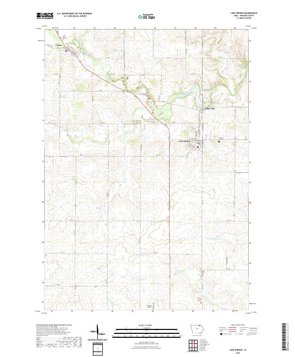
2022 Map of Lime Springs
USGS Topo · Published 2022About this map
The Upper Iowa River winds through the northern portion of Howard County, serving as a focal point for the early industries and settlements of the region. This 2022 survey captures the landscape around Lime Springs and Chester, where a grid of rural roads connects agricultural sections with historical landmarks like Lidtke Mill on the riverbank. The township boundaries of T100N and T99N define the jurisdictional layout, while natural drainages like Beaver Cr and the various branches of the Turkey River delineate the terrain. Local genealogy is anchored by features such as Pleasant Hill Cem, located along the section lines east of Lime Springs. The map reflects a classic Iowa prairie-border landscape, where the transition between the rolling river valleys and the organized township grids reveals a century of land use and river-dependent settlement.
Find a feature on this map
55 named features on this map. Tap any name to fly to it.
Don’t see what you’re looking for? This feature index may not catch every label — zoom into the map to look around manually.
Map Details
Editions of this 2022 Lime Springs Map
This is the sole edition of this map. No revisions or reprints were ever made.
Other maps of this area

1954 · Mason City
USGS Topo · 1:250,000

1957 · Mason City
USGS Topo · 1:250,000

1958 · Mason City
USGS Topo · 1:250,000

1965 · Greenleafton
USGS Topo · 1:24,000

1965 · Ostrander
USGS Topo · 1:24,000

1965 · Cherry Grove
USGS Topo · 1:24,000

1981 · Lourdes
USGS Topo · 1:24,000

1981 · Cresco NW
USGS Topo · 1:24,000

1981 · Lime Springs
USGS Topo · 1:24,000
1981 · Cresco SW
USGS Topo · 1:24,000