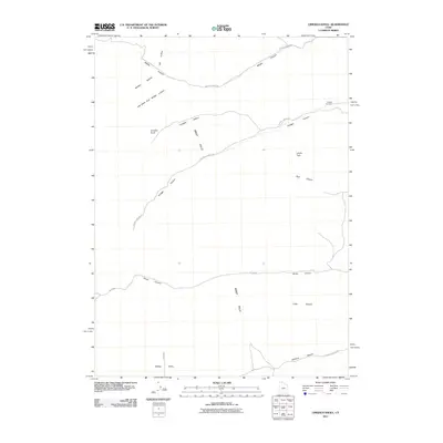
2011 Map of Limekiln Knoll
USGS Topo · Published 2011About this map
West Hills dominates this 2011 topographical study of Box Elder County, where high ridges and deep drainages define the landscape. The western face of the range is carved by a succession of canyons, including Middle Canyon, Portage Canyon, and Broad Canyon, which channel water toward the valley floors. At the foot of the hills, the Portage Cemetery remains a significant local historical point, overlooking the northern entrance to the valley.
Find a feature on this map
19 named features on this map. Tap any name to fly to it.
Don’t see what you’re looking for? This feature index may not catch every label — zoom into the map to look around manually.
Map Details
Editions of this 2011 Limekiln Knoll Map
This is the sole edition of this map. No revisions or reprints were ever made.
Other maps of this area

1954 · Pocatello
USGS Topo · 1:250,000

1954 · Brigham City
USGS Topo · 1:250,000

1958 · Pocatello
USGS Topo · 1:250,000

1958 · Brigham City
USGS Topo · 1:250,000

1962 · Brigham City
USGS Topo · 1:250,000
1964 · Riverside
USGS Topo · 1:24,000
1964 · Portage
USGS Topo · 1:24,000

1968 · Grover Canyon
USGS Topo · 1:24,000

1968 · Samaria
USGS Topo · 1:24,000
1968 · Henderson Creek
USGS Topo · 1:24,000