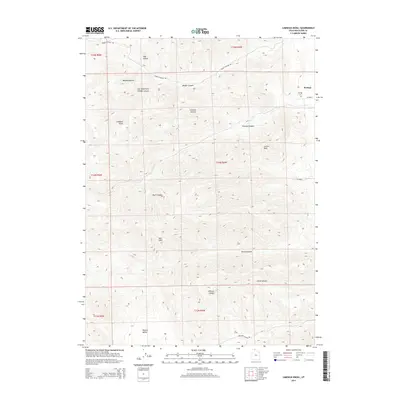
2014 Map of Limekiln Knoll
USGS Topo · Published 2014About this map
The high mountain terrain and deep canyons west of Portage are the focus of this 2014 survey. The landscape is defined by the West Hills and a series of dramatic drainages including Broad Canyon, Portage Canyon, and Middle Canyon. The topographic detail reveals the complex geography of the area, from the prominence of Lemon Peak and Limekiln Knoll to the high-elevation flats of Whites Valley.
Find a feature on this map
26 named features on this map. Tap any name to fly to it.
Don’t see what you’re looking for? This feature index may not catch every label — zoom into the map to look around manually.
Map Details
Editions of this 2014 Limekiln Knoll Map
This is the sole edition of this map. No revisions or reprints were ever made.
Other maps of this area

1954 · Pocatello
USGS Topo · 1:250,000

1954 · Brigham City
USGS Topo · 1:250,000

1958 · Pocatello
USGS Topo · 1:250,000

1958 · Brigham City
USGS Topo · 1:250,000

1962 · Brigham City
USGS Topo · 1:250,000
1964 · Riverside
USGS Topo · 1:24,000
1964 · Portage
USGS Topo · 1:24,000

1968 · Grover Canyon
USGS Topo · 1:24,000

1968 · Samaria
USGS Topo · 1:24,000
1968 · Henderson Creek
USGS Topo · 1:24,000