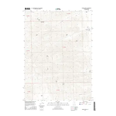
2017 Map of Limekiln Knoll
USGS Topo · Published 2017About this map
Portage sits at the edge of the high mountain terrain in Box Elder County, serving as the primary settlement on this northern Utah landscape. The topography is defined by the West Hills and a series of dramatic drainages including Middle Canyon, Portage Canyon, and Broad Canyon. Significant landmarks such as Lemon Peak and Limekiln Knoll overlook the township, while more secluded areas like Whites Valley and Ruff Canyon suggest a history of high-altitude ranching or resource extraction. The map preserves local markers of community and passage, from the Portage Cem on the edge of town to the winding routes of Middle Canyon Rd and Johnson Canyon Rd that push into the steeper elevations. This survey captures a moment in the modern era where traditional land divisions meet the enduring natural boundaries of these canyon systems.
Find a feature on this map
26 named features on this map. Tap any name to fly to it.
Don’t see what you’re looking for? This feature index may not catch every label — zoom into the map to look around manually.
Map Details
Editions of this 2017 Limekiln Knoll Map
This is the sole edition of this map. No revisions or reprints were ever made.
Other maps of this area

1954 · Pocatello
USGS Topo · 1:250,000

1954 · Brigham City
USGS Topo · 1:250,000

1958 · Pocatello
USGS Topo · 1:250,000

1958 · Brigham City
USGS Topo · 1:250,000

1962 · Brigham City
USGS Topo · 1:250,000
1964 · Riverside
USGS Topo · 1:24,000
1964 · Portage
USGS Topo · 1:24,000

1968 · Grover Canyon
USGS Topo · 1:24,000

1968 · Samaria
USGS Topo · 1:24,000
1968 · Henderson Creek
USGS Topo · 1:24,000