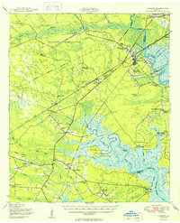
1950 Map of Limerick
USGS Topo · Published 1950About this map
The Ogeechee River and Medway River define this coastal Georgia landscape, where the tides of the Buttermilk Sound meet established inland settlements. In the post-war years, the area shows a distinct transition between the expanding Camp Stewart Military Reservation to the north and the historic educational and religious hubs of Midway and Dorchester to the south. The map provides significant genealogical value, documenting numerous segregated educational facilities such as the George Washington Carver School and the Dorchester Academy, alongside rural congregations like Ebenezer Church and St Paul Ch.
Find a feature on this map
82 named features on this map. Tap any name to fly to it.
Don’t see what you’re looking for? This feature index may not catch every label — zoom into the map to look around manually.
Map Details
Editions of this 1950 Limerick Map
2 editions found
Other maps of this area

1918 · Hinesville
USGS Topo · 1:62,500

1920 · Pembroke
USGS Topo · 1:62,500

1920 · Meldrim
USGS Topo · 1:62,500

1920 · Sapelo River
USGS Topo · 1:62,500

1920 · Limerick
USGS Topo · 1:62,500

1928 · St Catherines Island
USGS Topo · 1:62,500

1942 · Meldrim
USGS Topo · 1:62,500

1942 · Savannah
USGS Topo · 1:62,500

1943 · Ludowici
USGS Topo · 1:62,500

1943 · St Catherines Island
USGS Topo · 1:62,500