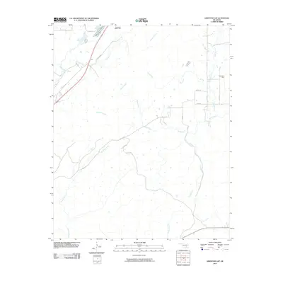
2010 Map of Limestone Gap
USGS Topo · Published 2010About this map
Gap serves as the focal point of this Atoka County landscape, marking a break in the high ground where transportation routes converge. This 2009 survey by the U.S. Geological Survey documents a region defined by a dense network of watercourses and rural roads. The hydrography is notably complex, with McGee Creek winding through the center, joined by numerous tributaries including Breadtown Creek, Doval Creek, and Nolleytubby Creek. The presence of Oknoname 005001 Dam and Dow Lake Dam highlights local water management and land use during this era. Rural life is traced along corridors like Chockie Mtn Rd and Wesley Rd, which connect isolated homesteads and parcels across the varied terrain of the Choctaw Nation region.
Find a feature on this map
23 named features on this map. Tap any name to fly to it.
Don’t see what you’re looking for? This feature index may not catch every label — zoom into the map to look around manually.
Map Details
Editions of this 2010 Limestone Gap Map
This is the sole edition of this map. No revisions or reprints were ever made.
Other maps of this area

1896 · Coalgate
USGS Topo · 1:125,000

1898 · McAlester
USGS Topo · 1:125,000

1899 · Coalgate
USGS Topo · 1:125,000

1899 · Atoka
USGS Topo · 1:125,000

1900 · Atoka
USGS Topo · 1:125,000

1900 · Coalgate
USGS Topo · 1:125,000

1901 · Antlers
USGS Topo · 1:125,000

1909 · Mc Alester
USGS Topo · 1:125,000

1912 · Antlers
USGS Topo · 1:125,000

1925 · Antlers
USGS Topo · 1:125,000