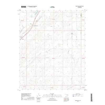
2019 Map of Limestone Gap
USGS Topo · Published 2019About this map
Limestone Ridge dominates the western landscape of this Atoka County region, creating a natural corridor where the settlement of Limestone Gap and its nearby Limestone Gap Cemetery were established. This area is characterized by a transition from the elevated peaks of Pine Mountain to a complex network of southern-flowing drainage systems, including McGee Creek, Chickasaw Creek, and Breadtown Creek. To the east, the rural community of Wesley is marked by the Wesley Cemetery, situated at a junction of local roads like Wesley Road and N4005 Road. The topographic data reveals a rugged topography where small water bodies like Martin Lake are fed by seasonal runs such as Buck Creek. This map preserves the 21st-century footprint of long-standing cattle-country communities and the distinct geological features that dictated their early placement.
Find a feature on this map
40 named features on this map. Tap any name to fly to it.
Don’t see what you’re looking for? This feature index may not catch every label — zoom into the map to look around manually.
Map Details
Editions of this 2019 Limestone Gap Map
This is the sole edition of this map. No revisions or reprints were ever made.
Other maps of this area

1896 · Coalgate
USGS Topo · 1:125,000

1898 · McAlester
USGS Topo · 1:125,000

1899 · Coalgate
USGS Topo · 1:125,000

1899 · Atoka
USGS Topo · 1:125,000

1900 · Atoka
USGS Topo · 1:125,000

1900 · Coalgate
USGS Topo · 1:125,000

1901 · Antlers
USGS Topo · 1:125,000

1909 · Mc Alester
USGS Topo · 1:125,000

1912 · Antlers
USGS Topo · 1:125,000

1925 · Antlers
USGS Topo · 1:125,000