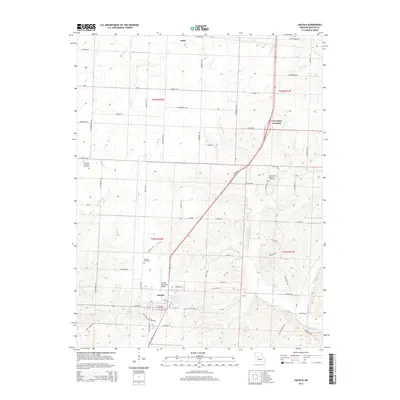
2014 Map of Lincoln
USGS Topo · Published 2014About this map
Lincoln serves as the central hub for this portion of Benton County, situated at the intersection of several local routes. The landscape transitions from the residential and municipal core of the town, including the Lincoln Municipal Airport and Timberline Lake, to a patchwork of rural farmsteads and family-named roads. Historically significant sites are scattered throughout the countryside, with several burial grounds such as Immanuel Lutheran Cemetery, Zion Cemetery, and the Mount Olivet Church Cemetery providing critical touchpoints for local genealogical research. Waterways like Cole Camp Cr, S Flat Cr, and Byler Br drain the area, while smaller settlements like Ionia and Cole Camp Junction mark northern points of interest. The network of section lines and secondary roads, including Keuper Rd and Sieving Rd, illustrates a well-established agrarian grid that has defined the region's development for generations.
Find a feature on this map
69 named features on this map. Tap any name to fly to it.
Don’t see what you’re looking for? This feature index may not catch every label — zoom into the map to look around manually.
Map Details
Editions of this 2014 Lincoln Map
This is the sole edition of this map. No revisions or reprints were ever made.
Other maps of this area

1887 · Sedalia
USGS Topo · 1:125,000

1887 · Warsaw
USGS Topo · 1:125,000

1894 · Warsaw
USGS Topo · 1:125,000

1894 · Sedalia
USGS Topo · 1:125,000

1936 · Shawnee Bend
USGS Topo · 1:24,000

1936 · Lakeview Heights
USGS Topo · 1:24,000

1936 · Schuyler
USGS Topo · 1:24,000

1947 · Jefferson City
USGS Topo · 1:250,000
1948 · Green Ridge
USGS Topo · 1:62,500

1954 · Jefferson City
USGS Topo · 1:250,000