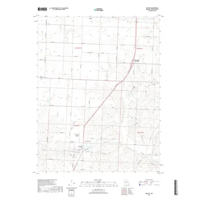
2017 Map of Lincoln
USGS Topo · Published 2017About this map
Lincoln serves as the primary hub in this portion of Benton County, situated at a junction of regional transit routes and local farm-to-market roads. The town's layout is centered around the intersection of Main Street and the highway, supported by the nearby Lincoln Municipal Airport. To the north and east, the settlements of Ionia and Cole Camp Junction anchor the rural landscape, which is defined by the winding paths of Cole Camp Cr and Byler Br.
Find a feature on this map
82 named features on this map. Tap any name to fly to it.
Don’t see what you’re looking for? This feature index may not catch every label — zoom into the map to look around manually.
Map Details
Editions of this 2017 Lincoln Map
This is the sole edition of this map. No revisions or reprints were ever made.
Other maps of this area

1887 · Sedalia
USGS Topo · 1:125,000

1887 · Warsaw
USGS Topo · 1:125,000

1894 · Warsaw
USGS Topo · 1:125,000

1894 · Sedalia
USGS Topo · 1:125,000

1936 · Shawnee Bend
USGS Topo · 1:24,000

1936 · Lakeview Heights
USGS Topo · 1:24,000

1936 · Schuyler
USGS Topo · 1:24,000

1947 · Jefferson City
USGS Topo · 1:250,000
1948 · Green Ridge
USGS Topo · 1:62,500

1954 · Jefferson City
USGS Topo · 1:250,000