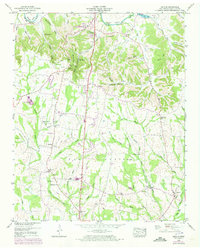
1949 Map of Lincoln
USGS Topo · Published 1973About this map
The Elk River carves a winding path through the northern reaches of this Lincoln County survey, creating dramatic loops at Morgan Bend and Henry Bend. This landscape is defined by its deep hollows and scattered rural communities, reflecting a mid-century agricultural economy tied to the land and local waterways. The southern boundary of Fayetteville is visible at the top, while the eponymous settlement of Lincoln sits in the southeast corner near the Flint River.
Find a feature on this map
59 named features on this map. Tap any name to fly to it.
Don’t see what you’re looking for? This feature index may not catch every label — zoom into the map to look around manually.
Map Details
Editions of this 1949 Lincoln Map
3 editions found
Other maps of this area

1888 · Scottsboro
USGS Topo · 1:125,000

1888 · Huntsville
USGS Topo · 1:125,000

1892 · Huntsville
USGS Topo · 1:125,000

1892 · Scottsboro
USGS Topo · 1:125,000

1936 · Flintville
USGS Topo · 1:24,000

1936 · Taft
USGS Topo · 1:24,000

1936 · Fisk
USGS Topo · 1:24,000

1936 · Boonshill
USGS Topo · 1:24,000

1936 · Lincoln
USGS Topo · 1:24,000

1936 · Toney
USGS Topo · 1:24,000