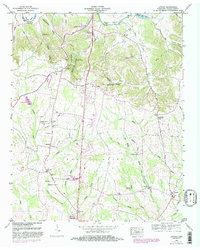
1949 Map of Lincoln
USGS Topo · Published 1982About this map
Fayetteville and the surrounding Lincoln County landscape are defined by the winding course of the Elk River, which carves deep bends like Morgan Bend and Henry Bend through the terrain. This Tennessee Valley Authority mapping reflects the mid-century transition of the area, showing the prominent Pea Ridge landform and the rural settlement patterns of the late 1940s. Local industry and infrastructure are represented by the Fayetteville Pumping Station, the Fayetteville Municipal Airport, and a Fish Hatchery near the southern boundary.
Find a feature on this map
62 named features on this map. Tap any name to fly to it.
Don’t see what you’re looking for? This feature index may not catch every label — zoom into the map to look around manually.
Map Details
Editions of this 1949 Lincoln Map
3 editions found
Other maps of this area

1888 · Scottsboro
USGS Topo · 1:125,000

1888 · Huntsville
USGS Topo · 1:125,000

1892 · Huntsville
USGS Topo · 1:125,000

1892 · Scottsboro
USGS Topo · 1:125,000

1936 · Flintville
USGS Topo · 1:24,000

1936 · Taft
USGS Topo · 1:24,000

1936 · Fisk
USGS Topo · 1:24,000

1936 · Boonshill
USGS Topo · 1:24,000

1936 · Lincoln
USGS Topo · 1:24,000

1936 · Toney
USGS Topo · 1:24,000