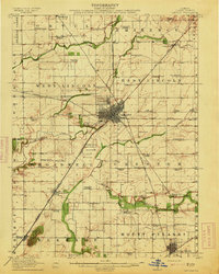
1913 Map of Lincoln
USGS Topo · Published 1913About this map
The Logan County prairie of the early 1910s reveals a landscape defined by an exceptionally dense network of rural schoolhouses and complex rail junctions. Lincoln sits at the heart of this grid, where the Chicago and Alton and Illinois Central lines intersect with the Illinois Traction System. This transit hub facilitated the growth of institutional sites like the County Farm and the Asylum Farm south of the city center.
Find a feature on this map
72 named features on this map. Tap any name to fly to it.
Don’t see what you’re looking for? This feature index may not catch every label — zoom into the map to look around manually.
Map Details
Editions of this 1913 Lincoln Map
3 editions found
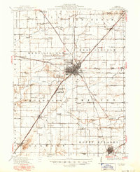
Other maps of this area

1907 · Springfield
USGS Topo · 1:62,500

1911 · Lincoln
USGS Topo · 1:62,500

1913 · Lincoln
USGS Topo · 1:62,500

1930 · Springfield
USGS Topo · 1:62,500

1940 · Springfield
USGS Topo · 1:62,500

1942 · Delavan
USGS Topo · 1:62,500

1948 · Mason City
USGS Topo · 1:62,500

1949 · Mason City
USGS Topo · 1:62,500

1949 · Mc Lean
USGS Topo · 1:62,500

1951 · McLean
USGS Topo · 1:62,500