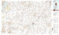
1989 Map of Lincoln
USGS Topo · Published 1989About this map
Lincoln serves as the central hub of this late-twentieth-century landscape, where the agricultural plains of Central Illinois are defined by an intricate network of drainage ditches and river systems. The Illinois River and Sangamon River form significant corridors to the west, while Salt Creek and Sugar Creek carve through the heart of Logan County. This period shows the established industrial and educational foundations of the area, anchored by Lincoln Christian College and the regional connectivity of the Illinois Central Gulf Railroad.
Find a feature on this map
191 named features on this map. Tap any name to fly to it.
Don’t see what you’re looking for? This feature index may not catch every label — zoom into the map to look around manually.
Map Details
Editions of this 1989 Lincoln Map
This is the sole edition of this map. No revisions or reprints were ever made.
Other maps of this area

1905 · Peoria
USGS Topo · 1:62,500

1907 · Springfield
USGS Topo · 1:62,500

1909 · Tallula
USGS Topo · 1:62,500

1911 · Lincoln
USGS Topo · 1:62,500

1912 · Canton
USGS Topo · 1:62,500

1913 · Lincoln
USGS Topo · 1:62,500

1925 · Havana
USGS Topo · 1:62,500

1926 · Normal
USGS Topo · 1:62,500

1927 · Peoria
USGS Topo · 1:62,500

1927 · Danvers
USGS Topo · 1:62,500