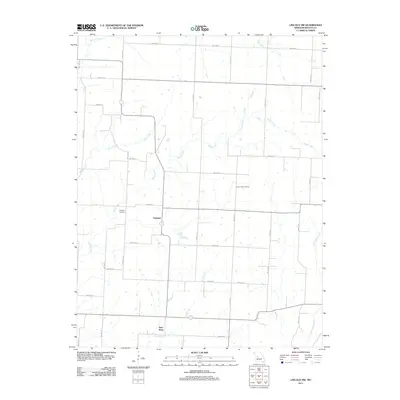
2011 Map of Lincoln NW
USGS Topo · Published 2011About this map
Santiago and Palo Pinto serve as the primary community nodes in this Benton County landscape, where the rural character is defined by a grid of agricultural section roads and meandering watercourses. The drainage of the area is particularly complex, with several significant streams including Brush Creek, Duck Creek, and Clear Creek carving through the prairie. Genealogists and local historians will find the location of Mcintyre Cemetery and Clover Dale Cemetery essential for tracing family roots in this corner of Missouri. The southeastern portion of the map is marked by the presence of Little Tebo Creek, illustrating how the region's topography is heavily influenced by these natural water boundaries. The road network, including routes like NW 1000th and Agee Rd, shows a highly structured approach to land division that contrasts with the fluid paths of the creeks.
Find a feature on this map
35 named features on this map. Tap any name to fly to it.
Don’t see what you’re looking for? This feature index may not catch every label — zoom into the map to look around manually.
Map Details
Editions of this 2011 Lincoln NW Map
This is the sole edition of this map. No revisions or reprints were ever made.
Other maps of this area

1885 · Warrensburg
USGS Topo · 1:125,000

1887 · Clinton
USGS Topo · 1:125,000

1887 · Sedalia
USGS Topo · 1:125,000

1887 · Warsaw
USGS Topo · 1:125,000

1887 · Warrensburg
USGS Topo · 1:125,000

1894 · Warsaw
USGS Topo · 1:125,000

1894 · Sedalia
USGS Topo · 1:125,000

1894 · Warrensburg
USGS Topo · 1:125,000

1894 · Clinton
USGS Topo · 1:125,000

1936 · Shawnee Bend
USGS Topo · 1:24,000