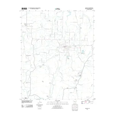
2011 Map of Lincoln
USGS Topo · Published 2011About this map
Lincoln serves as the central hub of this Northwest Arkansas landscape, where the Ozark terrain transitions from the heights of Sugartree Mountain into the drainage basins of Ballard Creek and Baron Fork. The settlement pattern reflects a deeply rooted rural community, anchored by numerous family and community burial grounds such as Sugar Hill Cemetery, White Rock Cemetery, and Bethesda Cemetery. Small historic centers like Canehill, Summers, and Dutch Mills are scattered across the quadrangle, each connected by a network of local roads including Canehill Rd and N Jackson Hwy. Water management is prominent in the eastern portion of the map, featuring Rodgers Lake and Cantrell Lake, both identified with their respective dams. The presence of both the Summers Post Office and Canehill Post Office underscores the persistence of these individual community identities within Washington County even into the 21st century.
Find a feature on this map
118 named features on this map. Tap any name to fly to it.
Don’t see what you’re looking for? This feature index may not catch every label — zoom into the map to look around manually.
Map Details
Editions of this 2011 Lincoln Map
This is the sole edition of this map. No revisions or reprints were ever made.
Other maps of this area

1898 · Tahlequah
USGS Topo · 1:125,000

1898 · Winslow
USGS Topo · 1:125,000

1899 · Fayetteville
USGS Topo · 1:125,000

1899 · Siloam Springs
USGS Topo · 1:125,000

1901 · Winslow
USGS Topo · 1:125,000

1901 · Fayetteville
USGS Topo · 1:125,000

1901 · Tahlequah
USGS Topo · 1:125,000

1903 · Siloam Springs
USGS Topo · 1:125,000

1904 · Siloam Springs
USGS Topo · 1:125,000

1904 · Fayetteville
USGS Topo · 1:125,000