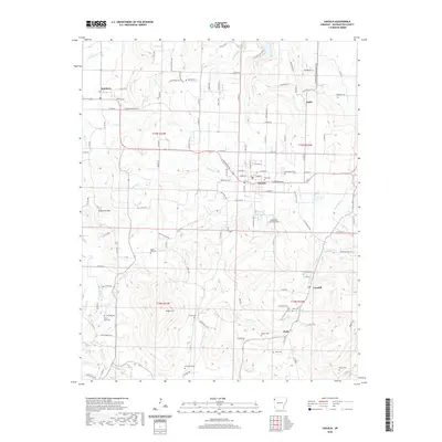
2020 Map of Lincoln
USGS Topo · Published 2020About this map
The ridge and valley system of the Ozark plateau defines this portion of Washington County, where the city of Lincoln serves as a central hub at the junction of several rural routes. The landscape is marked by numerous family-named cemeteries that reflect generations of local residency, including the Beatty Cem, Canehill Cem, and Mcclellan Cem. To the west, the terrain rises toward Sugartree Mtn, while small settlements like Summers and Canehill are linked by a network of county roads such as Co RD 4678 and Co RD 414.
Find a feature on this map
121 named features on this map. Tap any name to fly to it.
Don’t see what you’re looking for? This feature index may not catch every label — zoom into the map to look around manually.
Map Details
Editions of this 2020 Lincoln Map
This is the sole edition of this map. No revisions or reprints were ever made.
Other maps of this area

1898 · Tahlequah
USGS Topo · 1:125,000

1898 · Winslow
USGS Topo · 1:125,000

1899 · Fayetteville
USGS Topo · 1:125,000

1899 · Siloam Springs
USGS Topo · 1:125,000

1901 · Winslow
USGS Topo · 1:125,000

1901 · Fayetteville
USGS Topo · 1:125,000

1901 · Tahlequah
USGS Topo · 1:125,000

1903 · Siloam Springs
USGS Topo · 1:125,000

1904 · Siloam Springs
USGS Topo · 1:125,000

1904 · Fayetteville
USGS Topo · 1:125,000