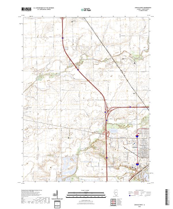
2024 Map of Lincoln West
USGS Topo · Published 2024About this map
The western edges of Lincoln and the small agricultural community of Hartsburg define this 2024 survey of Logan County. The landscape is characterized by the convergence of several major waterways, including Sugar Creek, Kickapoo Creek, and Salt Creek, which wind through a grid of rural section roads. For genealogists and local historians, the area is dotted with family and church burial grounds, from Union Cem in the north to the cluster of Saint Mary's Cem, Old Union Cem, and Holy Cross Cem on the outskirts of Lincoln. The map also captures the local aviation history at Martin Airport and the presence of Allison Lake, providing a clear record of the modern intersection between established farmland and the expanding western suburbs of the county seat.
Find a feature on this map
68 named features on this map. Tap any name to fly to it.
Don’t see what you’re looking for? This feature index may not catch every label — zoom into the map to look around manually.
Map Details
Editions of this 2024 Lincoln West Map
This is the sole edition of this map. No revisions or reprints were ever made.
Other maps of this area

1911 · Lincoln
USGS Topo · 1:62,500

1913 · Lincoln
USGS Topo · 1:62,500

1942 · Delavan
USGS Topo · 1:62,500

1948 · Mason City
USGS Topo · 1:62,500

1949 · Mason City
USGS Topo · 1:62,500

1951 · Minier
USGS Topo · 1:62,500

1958 · Peoria
USGS Topo · 1:250,000

1961 · Peoria
USGS Topo · 1:250,000

1963 · Peoria
USGS Topo · 1:250,000

1980 · Armington
USGS Topo · 1:24,000