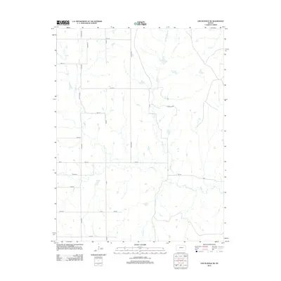
2012 Map of Lincolnville NE
USGS Topo · Published 2012About this map
Middle Cr and Stribby Cr carve a complex network of drainage across this portion of Marion County, defining a landscape largely shaped by its watercourses and a strict section-line road grid. The geography is primarily rural, characterized by the intersection of numerous local routes such as Bluestem Rd and Chase Co Rd. A significant point of local interest for genealogists and historians is Elk Cem, situated in the southern half of the quadrangle near the banks of Stribby Cr. The mapping of smaller tributaries like Pickett Cr and Wildcat Cr reveals the subtle topographic variations that have influenced agricultural patterns and land use in this Kansas prairie region.
Find a feature on this map
22 named features on this map. Tap any name to fly to it.
Don’t see what you’re looking for? This feature index may not catch every label — zoom into the map to look around manually.
Map Details
Editions of this 2012 Lincolnville NE Map
This is the sole edition of this map. No revisions or reprints were ever made.
Other maps of this area

1889 · Parkerville
USGS Topo · 1:125,000

1894 · Parkerville
USGS Topo · 1:125,000

1898 · Cottonwood Falls
USGS Topo · 1:125,000

1955 · Hutchinson
USGS Topo · 1:250,000

1957 · Elmdale
USGS Topo · 1:24,000

1957 · Cedar Point
USGS Topo · 1:24,000

1957 · Lincolnville SW
USGS Topo · 1:24,000

1957 · Hymer
USGS Topo · 1:24,000

1959 · Hutchinson
USGS Topo · 1:250,000

1970 · Lincolnville NE
USGS Topo · 1:24,000