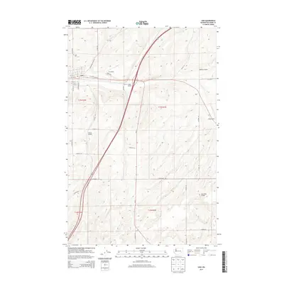
2014 Map of Lind
USGS Topo · Published 2014About this map
Lind serves as the focal point of this Eastern Washington landscape, where the town’s grid is defined by streets like W Main St and S Van Marter Rd. The settlement is situated at the confluence of a complex drainage system, most notably Lind Coulee, which carves through the terrain alongside Paha Coulee and McElroy Coulee. This geographic arrangement illustrates the importance of water management and topography in the development of the region's agricultural and transportation corridors. To the north of the town center, the Lind Cem and Lind Airport mark the community's established footprint, while the remote siding at Vassar to the east indicates the historical reach of rail-dependent transport. The surrounding landscape is defined by its series of distinct geological features, including the Sand Hills Coulee and Hatton Coulee, which shape the rural road network connecting local properties via routes such as N Wahl Rd and E Providence Rd.
Find a feature on this map
38 named features on this map. Tap any name to fly to it.
Don’t see what you’re looking for? This feature index may not catch every label — zoom into the map to look around manually.
Map Details
Editions of this 2014 Lind Map
This is the sole edition of this map. No revisions or reprints were ever made.
Other maps of this area

1916 · Connell
USGS Topo · 1:125,000

1918 · Connell
USGS Topo · 1:125,000

1923 · Washtucna
USGS Topo · 1:62,500

1925 · Washtucna
USGS Topo · 1:62,500

1953 · Walla Walla
USGS Topo · 1:250,000

1953 · Ritzville
USGS Topo · 1:250,000

1958 · Walla Walla
USGS Topo · 1:250,000

1959 · Ritzville
USGS Topo · 1:250,000

1965 · Ritzville
USGS Topo · 1:250,000

1967 · Reiman SW
USGS Topo · 1:24,000