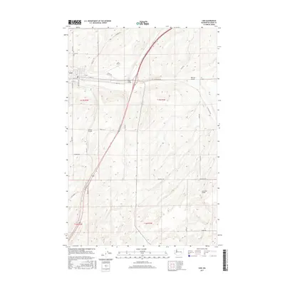
2017 Map of Lind
USGS Topo · Published 2017About this map
Lind, Washington, situated in the heart of Adams County, is the primary settlement shown on this 2017 topographic record. The landscape is defined by the distinctive coulees of the Inland Northwest, including Paha Coulee, McElroy Coulee, Hatton Coulee, and Sand Hills Coulee, which carve through the region's undulating terrain. Within the town, the street grid is clearly visible, featuring W Main St and Van Marter Ave near the Lind Airport. For those interested in local genealogy, the Lind Cem is situated just north of the town center. The map also documents an extensive network of rural infrastructure, such as Neilson Rd, Longmeier Rd, and Providence Rd, reflecting the agricultural character of this eastern Washington community. This detailed survey provides an accurate representation of the intersection between human development and the geological legacies of the Channeled Scablands.
Find a feature on this map
28 named features on this map. Tap any name to fly to it.
Don’t see what you’re looking for? This feature index may not catch every label — zoom into the map to look around manually.
Map Details
Editions of this 2017 Lind Map
This is the sole edition of this map. No revisions or reprints were ever made.
Other maps of this area

1916 · Connell
USGS Topo · 1:125,000

1918 · Connell
USGS Topo · 1:125,000

1923 · Washtucna
USGS Topo · 1:62,500

1925 · Washtucna
USGS Topo · 1:62,500

1953 · Walla Walla
USGS Topo · 1:250,000

1953 · Ritzville
USGS Topo · 1:250,000

1958 · Walla Walla
USGS Topo · 1:250,000

1959 · Ritzville
USGS Topo · 1:250,000

1965 · Ritzville
USGS Topo · 1:250,000

1967 · Reiman SW
USGS Topo · 1:24,000